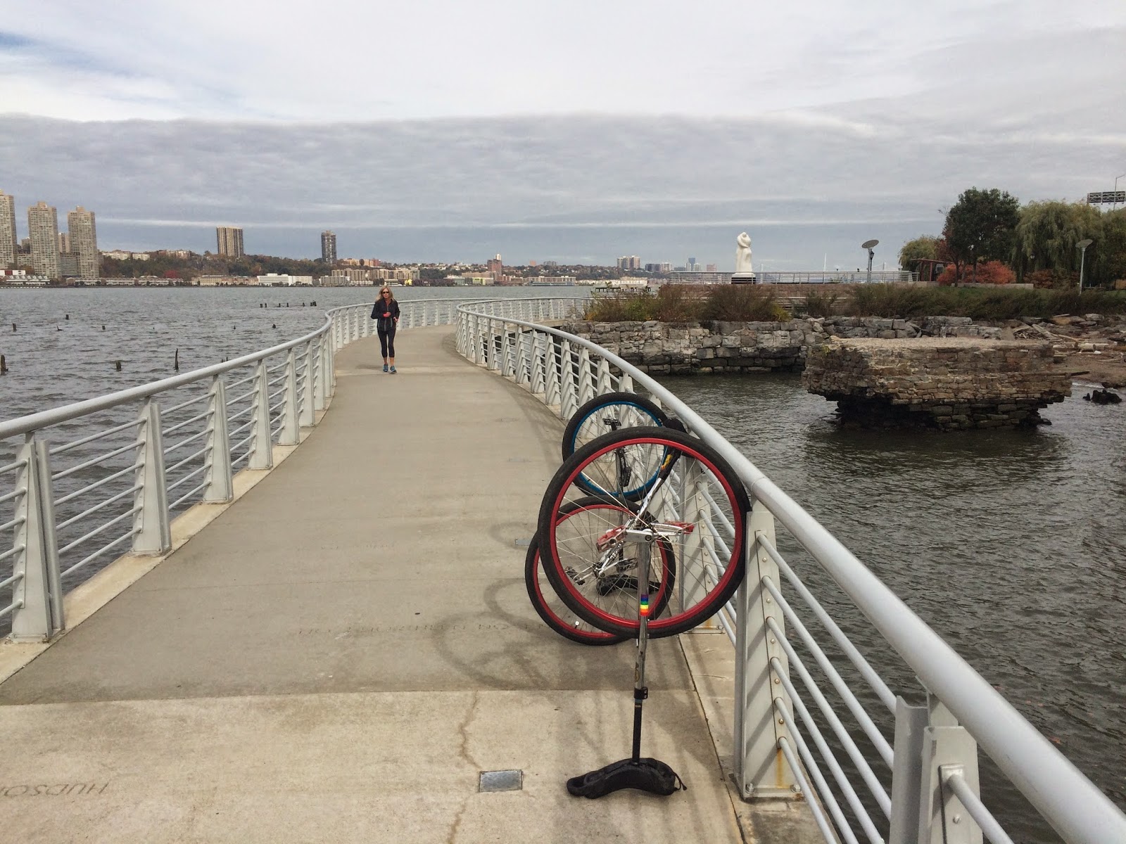
Small Bridge at Inwood Hill Park
May 20, 2015, Sophie Lrits, Rob Hickman, Keith Nelson
From Wikipedia:
Inwood Hill Park is a city-owned and maintained public park in the Inwood neighborhood of Manhattan, New York City, operated by the New York City Department of Parks and Recreation. It stretches along the Hudson River from Dyckman Street to the northern tip of the island. Inwood Hill Park's densely folded, glacially scoured topography contains the largest remaining forest land on Manhattan Island. Unlike other Manhattan parks, Inwood Hill Park is largely natural, being non-landscaped. As the current name suggests, large areas of the park are hills, mostly wooded.
Inwood Hill Park has a human history that goes back to the Pre-Columbian era. Through the 17th century, Native Americans known as the Lenape inhabited the area. There is evidence of a main encampment along the eastern edge of the park. The Lenape relied on both the Hudson and Harlem Rivers as sources for food. Artifacts and the remains of old campfires were found in Inwood's rock shelters, suggesting their use for shelter and temporary living quarters. Legend has it that under a tulip tree in the park Peter Minuit, Director General of New Netherland, 'purchased' Manhattan from the a band of Native Americans in 1626 for the Dutch West India Company; the purchase price being a shipment of goods worth 60 guilders. The tree, the largest tulip on the island, survived for centuries until it was felled by a storm in 1933. Until the 1950s the base of the tree under which this transaction allegedly took place was still to be seen, surrounded by a large iron fence, but as it rotted it was finally removed and a boulder (Shorakkopoch Rock) and plaque replaced it.
Fort Cockhill, one of many forts built in New York by the Continental Army during the Revolutionary War, stood slightly north from the center of Inwood Hill Park. A small, five-sided earthen structure equipped with two cannons, it overlooked the mouth of Spuyten Duyvil Creek at its confluence with the Hudson River. At the time, the area was known from Colonial to post-Revolutionary War times as Cox's Hill or Tubby Hook Hill.
By the 19th century, what would later be the Inwood Hill Park was the location to country retreats for some of the wealthier families of the community and the rest of New York's social elite. One such notable who had a summer estate in Inwood was Isidor Straus, co-owner of the Macy's department store and a passenger on the ill-fated voyage of the RMS Titanic. The Lords of the Lord & Taylor department store chain owned two mansions built within the park; both mansions were destroyed by fire in the latter part of the 19th century. Additionally, an orphanage was located high on a bluff in what is now Inwood Hill Park in the nineteenth century. The site today includes a small paved area and park benches; no trace of the building remains. At least three freshwater springs arise in the park, one of which was used for drinking water by the workers who constructed the Henry Hudson Bridge.
Between 1915 and the early 1940s, the City purchased some parcels of land that make up the park as it is today. The park was officially opened on May 8, 1926. Many trails were paved over and illuminated with lampposts as a project of the Works Progress Administration during the 1930s. At present, most of these paths and nearly all the lampposts are in dire need of repair.
On September 15, 1995, the Inwood Hill Nature Center was dedicated and opened to the public. It is located near the park entrance on 218th Street and Indian Road. The center is located on Manhattan's only salt-water marsh, and has been designated as an interactive exhibit with ongoing monitoring of the natural area. It is also the focal point to watch the eagles that have been placed in the park to be freed when they are able to adjust to the environment.
The park covers 196.4 acres (79.5 ha). The Henry Hudson Parkway and Amtrak's Empire Connection run through it, and at its northern end the Henry Hudson Bridge and the rail-only Spuyten Duyvil Bridge link Manhattan to the Bronx. Though the park does not support large wild mammals, the local wildlife does include raccoons and skunks as well as the usual city rodents. Both locals and people from outside the neighborhood fish from the riverbank at the north end of the park.
The park's western boundary is the Hudson River, and the southern boundary is 200th Street. From Dyckman Street to 204th Street the eastern boundary is Payson Avenue, from 204th to 214th Street it is Seaman Avenue, and from 215th Street to the park's end at 218th Street the eastern boundary is Indian Road. A number of foot paths criss-cross the park, allowing easy access to Dyckman Street, Fort Tryon Park, and the Riverside Park – part of the Manhattan Waterfront Greenway. Some of these trails are former roads leading to what were once summer estates that later were brought under the control of the city in the creation of the park. Bolton Road, which was the main drive to the Bolton estate, is now the primary pedestrian pathway within the park; its entrance marked by a sign located on Payson Avenue.
Inwood Hill Park is geologically diverse, with marble, schist, and limestone all prevalent in the area. The park is next to the seismologically active Dyckman Street Fault which runs parallel along the southern border of the park. As recently as 1989, activity of this fault caused a magnitude 2 earthquake.
The area of the park along the Harlem River includes one of Manhattan's last remaining natural salt marsh, the other being Smuggler's Cove, which attracts large numbers of waterbirds. These waterfowl can be studied further via educational programs held at the Nature Center at the north end of the property. Mallards, Canada geese and ring-billed gulls are year-round residents, using both the water and the nearby lawns and ballfields. Many wading birds and waterfowl pass through on the spring and fall migrations, and herons and cormorants often spend the summer.
The woods also support a wide variety of birds, including common species such as blue jays and cardinals. Birds of prey that breed in the park include red-tailed hawks and owls. A five-year project that began in summer 2002 is attempting to reintroduce the bald eagle to Manhattan using hacking boxes in the park and eaglets brought in from the Midwest. In the first summer, three of the four introduced eaglets fledged successfully; three or four fledged each year of the program. As of 2007, none had returned to nest in Manhattan, but most of the eagles raised in the park are too young to be nesting.
The lack of green space in the eastern part of Inwood and the Bronx nearby creates an enormous demand for picnicking with barbecues and table/chair setups, activity that is either illegal or tightly controlled in most city parks; however, Inwood Hill Park has managed this by permitting such setups on the manicured, maintained peninsula portion of the park. This has not been without controversy as during the warmer spring and summer months the area becomes unmanageable at times with a lack of policing in the later hours of the day leaving the area open to automobiles, motorcycles and larger open fires in undesignated areas. This is all allowed to happen without regard for safety or for the primal natural surroundings of the area.
The park contains three children's playgrounds, baseball and soccer fields, and tennis and basketball courts. The Inwood Hill Nature Center at the north end of the park is both a location for educational programs and the local headquarters of the Urban Park Rangers. Inwood Hill Park's ballfields are heavily used by local and other city Spanish-language leagues during the long baseball season. It is not uncommon to see hundreds, if not thousands, of uniformed players and spectators at the Dyckman Fields and Seaman Avenue ballpark compounds. This usage places extreme pressure on the park, which, as a result, has required more active management in recent years.