Friday, October 31, 2014

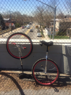
#389 Pedestrian Overpass to the Intrepid Sea, Air, & Space Museum


Pedestrian Overpass to the Intrepid Sea, Air, & Space Museum
October 31, 2014, Rob Hickman, Keith Nelson, Daryll John

View on Unicycle NYC Bridge Tour Map at: unibridgetour.net

#388 Hudson River Greenway Span at W. 62nd Street


Hudson River Greenway Span at W. 62nd Street
October 31, 2014, Rob Hickman, Keith Nelson, Daryll John

#387 Hudson River Greenway Span at W. 68th Street


Hudson River Greenway Span at W. 68th Street
October 31, 2014, Daryll John, Keith Nelson, Rob Hickman

#386 Hudson River Greenway Span at W. 88th Street


Hudson River Greenway Span at W. 88th Street
October 31, 2014, Keith Nelson, Rob Hickman, Daryll John

Wednesday, June 18, 2014

#385 Pedestrian Bridge at Transmitter Park, Greenpoint, Brooklyn


Pedestrian Bridge at Transmitter Park, Greenpoint, Brooklyn
June 18, 2014, Rob Hickman, Keith Nelson

Ride Time: 37:50
Distance: 4.03 miles
Average Speed: 6.38 mph
Fastest Speed: 11.10 mph
Ascent: 35 feet
Descent: 37 feet

Tuesday, June 3, 2014

#384 Wooden pedestrian bridge #4 over Simonson’s Creek, Brookville Park, Rosedale Queens


Wooden pedestrian bridge #4 over Simonson’s Creek, Brookville Park, Rosedale Queens
June 3, 2014, Rob Hickman, Keith Nelson

Started: Jun 3, 2014, 12:33:52 PM
Ride Time: 31:02
Distance: 2.88 miles
Average Speed: 5.55 mph
Fastest Speed: 9.37 mph

#383 Wooden pedestrian bridge #3 over Simonson’s Creek, Brookville Park, Rosedale Queens


Wooden pedestrian bridge #3 over Simonson’s Creek, Brookville Park, Rosedale Queens
June 3, 2014, Rob Hickman, Keith Nelson

#382 Pedestrian bridge over Simonson’s Creek, Brookville Park, Rosedale Queens


Pedestrian bridge over Simonson’s Creek, Brookville Park, Rosedale Queens
June 3, 2014, Keith Nelson, Rob Hickman

#381 Wooden pedestrian bridge #2 over Simonson’s Creek, Brookville Park, Rosedale Queens


Wooden pedestrian bridge #2 over Simonson’s Creek, Brookville Park, Rosedale Queens
June 3, 2014, Keith Nelson, Rob Hickman

#380 Wooden pedestrian bridge over Simonson’s Creek, Brookville Park, Rosedale Queens


Wooden pedestrian bridge over Simonson’s Creek, Brookville Park, Rosedale Queens
June 3, 2014, Keith Nelson, Rob Hickman

#379 147th Avenue over Simonson’s Creek


147th Avenue over Simonson’s Creek
June 3, 2014, Keith Nelson, Rob Hickman

#378 Rockaway Boulevard over Hook Creek connecting Queens to Nassau County


Rockaway Boulevard over Hook Creek connecting Queens to Nassau County
June 3, 2014, Keith Nelson, Rob Hickman

#377 Hook Creek Pedestrian Bridge connecting Queens to Nassau County


Hook Creek Pedestrian Bridge connecting Queens to Nassau County
June 3, 2014, Keith Nelson, Rob Hickman


Wooden bridge crosses more than Hook Creek
Suburban Long Island on one side, gritty Queens on the other
July 28, 2002 | By Sarah Kershaw | NEW YORK TIMES NEWS SERVICE


On a map, even the daintiest thumb would cover the knob of land and water in a hidden place where the city and suburbia meet, at a wooden footbridge separating the haves from the have-nots.

The 75-foot bridge arches over Hook Creek, which runs through southeast Queens and into Nassau County, forming the border and feeding Jamaica Bay. Half the bridge is on Long Island, the other half in New York City.

On one side of the bridge is Meadowmere Park, a middle-class Long Island community with its own firehouse, smoothly paved roads, lush and landscaped yards and an address that allows parents to send their children to first-rate local schools.

On the other side is Meadowmere, Queens, a century-old enclave of fishermen, mechanics and ironworkers, where the four potholed and bumpy streets - none of them appearing on the official city map - were paved once in the last 50 years and flood every time it rains, becoming impassable when the moon tides come. The first sewer system, if all goes according to plan, should be installed and working by about 2007.

Tucked between Kennedy International Airport - a mile from touchdown - and the start of Long Island's shopping-mall sprawl, Meadowmere, Queens, and the footbridge to suburbia are not easy to find.

One might stumble on it during a stroll on Long Island - Meadowmere Park is neatly marked on the map - but a map is of no use in getting there from the Queens side.

The city's Fire Department was once unable to find it, so firefighters from the Long Island side rushed over the footbridge when a Queens house was ablaze, several residents recalled.

For the most part, though, obscurity suits the people of Meadowmere, except when the neighborhood of two dozen houses is so obscure that people - official city types responsible for sewers and roads and drainage and snow plowing - forget that it is there.

Told by a visitor that the city was designing a sewer system for Meadowmere, Bob Seaman, who runs the M&B bait shop with his wife, Mary, and grew up in the neighborhood, was skeptical.

"We'll be old and gray before they do anything around here," he said the other day at the shop, where he was making the occasional sale of squid strips and blood worms. "It's like the lost colony down here."

Seaman, 54, pointed to the street outside, where a fire hydrant stands on a raised concrete platform. "They were supposed to raise all the streets 8 inches," he said. "They got as far as the fire hydrant."

Things are always different on the other side of the footbridge. Meadowmere Park, a cluster of about 90 houses that are in the Town of Hempstead, is scheduled for a repaving of its streets soon - making them 16 inches higher - to ensure continued protection from flooding.

Meadowmere residents pay a fraction of the property taxes the Meadowmere Park residents pay. But many on the Queens side pay to send their children to private schools, especially high school, rather than send them to troubled Springfield Gardens High School.

Lawrence High School, the neighborhood school for Meadowmere Park, has a stellar reputation and its students often win prestigious science competitions and other awards.

The lack of sewers in Meadowmere is a big deal to people on both sides of the bridge. Residents in Queens say they have fought for years to get the project rolling. And some on the Long Island side say it is frustrating to call New York City officials to complain about the stench of the waste dumped from the Queens houses into the creek.

"If I call the city, there are just too many departments," said Ruth Samuelson, a retired flea market manager who has lived on West Avenue in Meadowmere Park for 32 years.

"Several times I called to talk about Meadowmere, and they didn't know what I was talking about," she said, standing on the Long Island side of Hook Creek, in the back yard of a neighbor who has tall hedges in the front of his house and a handsome goldfish pond in the back. "They said those people don't exist."

Technically, the streets of Meadowmere did not exist as part of New York City until 1995, when the neighborhood got some rare attention and the Queens borough president's office went through the labyrinthine legal process of taking title to private streets.

But the neighborhood, now that it officially belongs to New York City, is entitled to all municipal services. City officials from the three departments handling the sewers and the repaving of the streets there said the entire project - from toilets to storm drains to potholes - would be finished in about 2007.

Community Board 13 in Queens, which covers Meadowmere, is planning to hold a meeting in the next few months to give residents information about the project, officials said. Connecting to the sewer system could cost each homeowner up to $5,000, in addition to monthly costs that would be almost triple their current water bills.

Meanwhile, the people of Meadowmere and their neighbors in Meadowmere Park, who sometimes mingle at bake sales or benefits at the firehouse on the Long Island side, are not convinced that any of this will actually happen. Seaman, whose father, a truck driver, settled in Meadowmere in the 1920s, is about as close as anyone is to being a historian of the neighborhood. "This place hasn't changed in 40 years," he said. "The trees have gotten a little taller, but that's about it."

Monday, April 21, 2014

#376 Pedestrian Overpass over I-495 Long Island Expressway at Peck Ave


Pedestrian Overpass over I-495 Long Island Expressway at Peck Ave
April 21, 2014, Rob Hickman, Keith Nelson

Ride Time: 1:53:07
Distance: 10.91 miles
Average Speed: 5.79 mph

#375 Long Island Motor Parkway (aka Vanderbilt Parkway) overpass over 73rd Ave


Long Island Motor Parkway (aka Vanderbilt Parkway) overpass over 73rd Ave
April 21, 2014, Rob Hickman, Keith Nelson


From Wikipedia:
The Long Island Motor Parkway (LIMP), also known as the Vanderbilt Parkway and Motor Parkway, was a parkway on Long Island, New York, in the United States. It was the first roadway designed for automobile use only. The road was privately built by William Kissam Vanderbilt II with overpasses and bridges to remove intersections. It opened in 1908 as a toll road and closed in 1938 when it was taken over by the state of New York in lieu of back taxes. Parts of the parkway survive today in sections of other roadways and as a bicycle trail in Queens.

Origins and construction
William Kissam Vanderbilt II, the great-grandson of Cornelius Vanderbilt, was an auto-racing enthusiast and created the Vanderbilt Cup, the first major road racing competition, in 1904. He ran the races on local roads in Nassau County during the first decade of the 20th century, but the deaths of two spectators and injury to many others showed the need to eliminate racing on residential streets. Vanderbilt responded by floating a company to build a graded, banked and grade-separated highway suitable for racing that was also free of the dust churned up by horses. The resulting Long Island Motor Parkway, with its banked turns, guard rails, reinforced concrete tarmac, and controlled access, was the first limited-access roadway in the world.

The road was originally planned to stretch for 70 miles (113 km) in and out of New York City as far as Riverhead, the county seat of Suffolk County, and point of division for the north and south forks of Long Island. Only 45 miles (from Queens in New York City to Lake Ronkonkoma) were constructed, at a cost of $6 million. Construction began in June 1908 (a year after the Bronx River Parkway), and a 10-mile-long section opened as far as modern Bethpage in October 1908, making it the first superhighway. It hosted races in 1908 and on the full road in 1909 and 1910, but an accident in the latter year, killing four with additional injuries, caused the New York Legislature to ban racing except on race tracks, ending its career as a racing road.

By 1911, the road was extended to Lake Ronkonkoma. It was the first roadway designed exclusively for automobile use, the first concrete highway in the United States, and the first to use overpasses and bridges to eliminate intersections.

Access
It was a toll road, with access at a small number of toll booths, joined to local roads by short connector roads. Traffic could turn left between the parkway and connectors, crossing oncoming traffic, so it was not a freeway. Access points were:

Nassau Boulevard (New York State Route 25D or NY 25D) west of Francis Lewis Boulevard. The right-of-way of Nassau Boulevard was later used for the Long Island Expressway (Interstate 495 or I-495).
Hillside Avenue (NY 25B) – Springfield Boulevard south of 77th Avenue
Great Neck – Lakeville Road south of Lake Road
Roslyn – Roslyn Road south of Barnyard Lane
Mineola – Jericho Turnpike (NY 25) at Rudolph Drive
Garden City – Clinton Road at Vanderbilt Court
Meadow Brook – Merrick Avenue north of Stewart Avenue
Bethpage – Hicksville Road (NY 107) south of Avoca Avenue; Round Swamp Road south of Old Bethpage Road
Huntington – Broad Hollow Road north of Spagnoli Road
Deer Park – Deer Park Road (NY 231)
East Commack – Commack Spur along Harned Road (CR 14) to Jericho Turnpike (NY 25)
Brentwood – Washington Avenue
Ronkonkoma – Rosevale Avenue

When the parkway opened, the toll was set at $2. It was reduced to $1.50 in 1912, $1 in 1917, and 40 cents in 1938. The first six toll houses were designed by John Russell Pope, the architect who designed the rotunda in the American Museum of Natural History and the Jefferson Memorial. The toll houses were designed to include living space for the toll collectors so that toll could be collected at all hours. The most prominent remaining toll house is in Garden City. Once located at the junction of Clinton Road and Vanderbilt Court, it was moved in 1989 to 230 Seventh Street, now the headquarters of the Garden City Chamber of Commerce.

Demise
Roadway design advances of the 1920s rendered the road obsolete less than 20 years after construction. At the same time Robert Moses was planning the Northern State Parkway. Initially the owners and some Long Island officials wanted the road integrated into the state parkway system, despite its narrow roadway and steep bridges not meeting new standards. Moses was against the idea, stating that the parkway would need significant reconstruction. The completion of the Northern State Parkway signaled the end for the road. In 1938 it was sold to New York State for $80,000 in lieu of back taxes and closed.Most of the road in Queens (west of Winchester Boulevard, whose widening destroyed an overpass) is a bicycle trail from Cunningham Park to Alley Pond Park, part of the Brooklyn–Queens Greenway.

The Nassau County roadway has been developed, or turned into a right of way for Long Island Power Authority transmission lines. Part of the road in Suffolk County is County Route 67 (CR 67) and parts were incorporated into the Meadowbrook State Parkway.

Preservation
In 2005, two historians / preservationists voiced their intention of preserving undeveloped portions of the road as part of a historical hike/bike trail (minus the existing Queens trail segment), submitting a formal proposal to Nassau County, Suffolk County, the Long Island Power Authority (which uses several portions of the old right-of-way to run powerlines) and the State of New York. Work is expected to begin in the near future, and most of that work will be carried out by the New York State Department of Transportation.

Anniversaries
In 2008 the road celebrated its 100th anniversary. On October 30, 2011, a centennial event marked the 100th anniversary of the completion of the Lake Ronkonkoma section. Led by the winner of the 1909 and 1910 Vanderbilt Cup races, a parade of automobiles made prior to 1948 went from Dix Hills to Lake Ronkonkoma.

Remaining portions
County Route 67 Location: Huntington–Lake Ronkonkoma Length: 14.51 mi (23.35 km) Most of the road from Queens to western Suffolk County has been obliterated by homes, other roads and structures, or has returned to nature. Some parts can be traced, and some bridges still exist.

The western portion in Queens was reopened a few months after closure as a bicycle path from Cunningham Park to Alley Pond Park. Now part of the Brooklyn–Queens Greenway (BQGW), it starts at Francis Lewis Boulevard in Cunningham Park where a bridge over the Long Island Expressway connects it to a park, formerly called Black Stump Park, which in turn connects Cunningham Park with Kissena Park. There is access to Peck Avenue just east of the start of the bike path.

The Greenway runs south, parallel with 199th Street, and crosses a bridge over 73rd Avenue. It swings east to Francis Lewis Boulevard, crossing it on a bridge. It continues through the park, crossing the Clearview Expressway by a tunnel, and then Hollis Hills Terrace on a fourth bridge before leaving the park. There is access to 209th and 210th Streets in Hollis Hills. It goes through a wooded corridor, soon crossing over Bell Boulevard on a bridge, and provides access to 220th Street just east of Bell Boulevard. After crossing Springfield Boulevard on another bridge, there is access to Cloverdale Boulevard where the main line of BQGW goes north. The road now enters Alley Pond Park, crosses under the Grand Central Parkway, and provides access to Union Turnpike before ending at Union Turnpike and Winchester Boulevard at the park's eastern boundary.

The road survives as a continuous county road, Vanderbilt Motor Parkway (CR 67), from Half Hollow Road in Dix Hills to its original end in Ronkonkoma, just a few blocks short of the lake. Signage along the way also identifies it variously as Vanderbilt Parkway and Motor Parkway. From Half Hollow Road, it goes northeast to NY 231 (Deer Park Avenue). It starts to parallel the Northern State Parkway and intersects with CR 4 (Commack Road) in Commack. It crosses the Sagtikos State Parkway (with northbound access northbound) and heads south to I-495 (the Long Island Expressway). The parkway heads eastward, paralleling the expressway (with access to and from the LIE) before ultimately crossing it and continuing southeast to NY 111 (Joshua's Path). It then heads north, crossing the LIE again at exit 57, and then curves to the east and crosses NY 454 (Veterans Memorial Highway). It heads east across Old Nichols and Terry roads ahead of one final northeastward turn to end at Rosedale Avenue (CR 93) in Ronkonkoma, close to the lake.

Though not a limited access road since 1938, most of the road was recognizable into the 1970s, while new intersections continued to be cut through it. In the approximate middle of the road in and around Islandia, office construction and other commercial building has widened the road and made it appear a typical highway. Other portions, especially at the western and eastern ends of the surviving road, can be enjoyed for greenery, graded and banked turns, and rolling hills, albeit at considerably less than racecar speeds.

#374 Long Island Motor Parkway (aka Vanderbilt Parkway) overpass over Francis Lewis Blvd


Long Island Motor Parkway (aka Vanderbilt Parkway) overpass over Francis Lewis Blvd
April 21, 2014, Rob Hickman, Keith Nelson

#373 Long Island Motor Parkway (aka Vanderbilt Parkway) overpass over Alley Pond Main Trail


Long Island Motor Parkway (aka Vanderbilt Parkway) overpass over Alley Pond Main Trail
April 21, 2014, Keith Nelson, Rob Hickman

#372 Long Island Motor Parkway (aka Vanderbilt Parkway) overpass over Alley Pond Park Trail


Long Island Motor Parkway (aka Vanderbilt Parkway) overpass over Alley Pond Park Trail
April 21, 2014, Keith Nelson, Rob Hickman

#371 Long Island Motor Parkway (aka Vanderbilt Parkway) overpass over Springfield Blvd


Long Island Motor Parkway (aka Vanderbilt Parkway) overpass over Springfield Blvd
April 21, 2014, Keith Nelson, Rob Hickman

#370 Long Island Motor Parkway (aka Vanderbilt Parkway) overpass over Bell Blvd


Long Island Motor Parkway (aka Vanderbilt Parkway) overpass over Bell Blvd
April 21, 2014, Keith Nelson, Rob Hickman

#369 Long Island Motor Parkway (aka Vanderbilt Parkway) Overpass over Hollis Hills Terrace


Long Island Motor Parkway (aka Vanderbilt Parkway) Overpass over Hollis Hills Terrace
April 21, 2014, Rob Hickman, Keith Nelson

Friday, March 28, 2014

#368 86th Street overpass over MTA ’N’ line


86th Street overpass over MTA ’N’ line
Bensonhurst, Brooklyn
March 28, 2014, Rob Hickman, Keith Nelson

Started: Mar 28, 2014, 10:45:39 AM
Ride Time: 1:44:12
Distance: 6.78 miles
Average Speed: 3.91 mph

#367 Avenue U overpass over MTA ’N’ line


Avenue U overpass over MTA ’N’ line
Bensonhurst, Brooklyn
March 28, 2014, Rob Hickman, Keith Nelson

#366 Avenue T overpass over MTA ’N’ line


Avenue T overpass over MTA ’N’ line
Bensonhurst, Brooklyn
March 28, 2014, Rob Hickman, Keith Nelson

#365 Avenue S overpass over MTA ’N’ line


Avenue S overpass over MTA ’N’ line
Bensonhurst, Brooklyn
March 28, 2014, Rob Hickman, Keith Nelson

#364 Highlawn Avenue overpass over MTA ’N’ line


Highlawn Avenue overpass over MTA ’N’ line
Bensonhurst, Brooklyn
March 28, 2014, Keith Nelson, Rob Hickman

#363 King’s Highway overpass over MTA ’N’ line


King’s Highway overpass over MTA ’N’ line
Bensonhurst, Brooklyn
March 28, 2014, Keith Nelson, Rob Hickman

#362 Avenue P overpass over MTA ’N’ line


Avenue P overpass over MTA ’N’ line
Bensonhurst, Brooklyn
March 28, 2014, Keith Nelson, Rob Hickman

#361 Avenue O overpass over MTA ’N’ line


Avenue O overpass over MTA ’N’ line
Bensonhurst, Brooklyn
March 28, 2014, Keith Nelson, Rob Hickman

#360 Bay Parkway overpass over MTA ’N’ line


Bay Parkway overpass over MTA ’N’ line
Bensonhurst, Brooklyn
March 28, 2014, Keith Nelson, Rob Hickman

#359 65th Street overpass over MTA ’N’ line


65th Street overpass over MTA ’N’ line
Bensonhurst, Brooklyn
March 28, 2014, Keith Nelson, Rob Hickman

#358 21st Avenue overpass over MTA ’N’ line


21st Avenue overpass over MTA ’N’ line
Bensonhurst, Brooklyn
March 28, 2014, Keith Nelson, Rob Hickman

#357 20th Avenue overpass over MTA ’N’ line


20th Avenue overpass over MTA ’N’ line
Bensonhurst, Brooklyn
March 28, 2014, Keith Nelson, Rob Hickman

#356 19th Avenue overpass over MTA ’N’ line


19th Avenue overpass over MTA ’N’ line
Bensonhurst, Brooklyn
March 28, 2014, Rob Hickman, Keith Nelson

#355 18th Avenue overpass over MTA ’N’ line


18th Avenue overpass over MTA ’N’ line
Bensonhurst, Brooklyn
March 28, 2014, Rob Hickman, Keith Nelson

#354 17th Avenue overpass over MTA ’N’ line


17th Avenue overpass over MTA ’N’ line
Bensonhurst, Brooklyn
March 28, 2014, Keith Nelson, Rob Hickman

#353 New Utrecht Avenue overpass over MTA ’N’ line


New Utrecht Avenue overpass over MTA ’N’ line
Bensonhurst, Brooklyn
March 28, 2014, Keith Nelson, Rob Hickman

#352 15th Avenue overpass over MTA ’N’ line


15th Avenue overpass over MTA ’N’ line
Bensonhurst, Brooklyn
March 28, 2014, Keith Nelson, Rob Hickman

#351 16th Avenue overpass over MTA ’N’ line


16th Avenue overpass over MTA ’N’ line
Bensonhurst, Brooklyn
March 28, 2014, Keith Nelson, Rob Hickman

Wednesday, January 8, 2014

#350 Pedestrian Overpass over Prospect Expressway at Greenwood Ave


Pedestrian Overpass over Prospect Expressway at Greenwood Ave
Windsor Terrace, Brooklyn
January 8th, 2014, Keith Nelson, Rob Hickman

#349 9th Ave Overpass over MTA 36th–38th Street Yard


9th Ave Overpass over MTA 36th–38th Street Yard
Sunset Park, Brooklyn
January 8th, 2014, Rob Hickman, Keith Nelson

From Wikipedia:
The 36th–38th Street Yard is located between Fifth and Seventh Avenues in Sunset Park, Brooklyn, adjacent to the Jackie Gleason Bus Depot. This yard is not normally used for revenue-service train maintenance, though some trains for the R service are stored here. Its primary function is to store diesel and electrically powered maintenance-of-way and other non-revenue service rolling stock. It is also used to transfer trash from garbage collector trains to trucks via platforms inside the yard just south of 37th Street.

This southern part of the yard was formerly the center of the South Brooklyn Railway, which extended from Bush Terminal through the north part of the yard, then down Gravesend Avenue and into the Coney Island Yard. The yard is entirely equipped with hand-operated switches. Only Fresh Pond Yard and East New York Yard share this characteristic.

#348 9th Ave Overpass over MTA ‘D’ line


9th Ave Overpass over MTA ‘D’ line
Sunset Park, Brooklyn
January 8th, 2014, Keith Nelson, Rob Hickman

MTA Arts for Transit artwork 'Bees for Sunset Park' by Christopher Russell

#347 4th Ave Overpass over South Brooklyn Railway


4th Ave Overpass over South Brooklyn Railway
Sunset Park, Brooklyn
January 8th, 2014, Keith Nelson, Rob Hickman

From Wikipedia:
The South Brooklyn Railway (reporting mark SBK) is a railroad in the New York City borough of Brooklyn. It continues to operate today as a subsidiary of New York City Transit Authority. Its original main line ran parallel to 38th Street from the Upper New York Bay to McDonald Avenue, and south on McDonald Avenue to the Coney Island Yards, mostly underneath the ex-Culver Shuttle and IND Culver Line of the New York City Subway.

The line still exists in parts. The section between the BMT West End Line's Ninth Avenue station and its interchange yard at Second Avenue and 39th Street is still open. The section under the Culver El has been paved over.

The South Brooklyn Railroad and Terminal Company was incorporated September 30, 1887 to build from the end of the Brooklyn, Bath and West End Railroad (West End Line) at 38th Street and 9th Avenue northwest to the foot of 38th Street, and was leased to the BB&WE, allowing BB&WE trains to run to the 39th Street Ferry. The Prospect Park and South Brooklyn Railroad connected the Prospect Park and Coney Island Railroad (Culver Line) to the South Brooklyn Railroad in 1890.[citation needed] The company was reorganized as the South Brooklyn Railroad on January 13, 1900. The South Brooklyn Railway was leased to the Brooklyn Heights Railroad on July 1, 1903, but on February 28, 1907 it began operating independently, and leased the Prospect Park and Coney Island Railroad, which included the Prospect Park and South Brooklyn Railroad, giving it a line to Coney Island.

The South Brooklyn Railway, along with the other non-rapid transit properties of the Brooklyn–Manhattan Transit Corporation, was transferred to the New York City Board of Transportation on June 1, 1940; operations were transferred to the New York City Transit Authority on June 15, 1953.

The South Brooklyn Railway provides one of only two track connections between the New York City Subway and the rest of the American rail network. During the 1988 and 1999 reconstruction of the subway tracks on the Williamsburg Bridge, this connection allowed trains from the J/Z, L and M services, which were isolated during that period, to travel to Coney Island Yard for major work. At the other mainline rail connection at the Linden Shops, subway trains traveled via the Bay Ridge Branch of the Long Island Rail Road, to the Brooklyn Army Terminal. From there, the New York Cross Harbor Railroad brought the cars up to the interchange yard at Second Avenue, where the South Brooklyn Railway took them to Coney Island Yard via the BMT West End Line.

The South Brooklyn Railway has two locomotives, N1 and N2, a pair of GE 47T Diesels. They can also be seen on the subway when not needed for the SBK.

As of May 2012, the interchange with New York New Jersey Rail, LLC at the Second Avenue Yard has been refurbished. A new ramp was installed at the 38th Street Yard at Fourth Avenue to allow receipt of new R156 locomotives and other subway rolling stock that are delivered on flat cars.

#346 5th Ave Overpass over Maple Ave (Green-Wood Cemetery)


5th Ave Overpass over Maple Ave (Green-Wood Cemetery)
Sunset Park, Brooklyn
January 8th, 2014, Keith Nelson, Rob Hickman